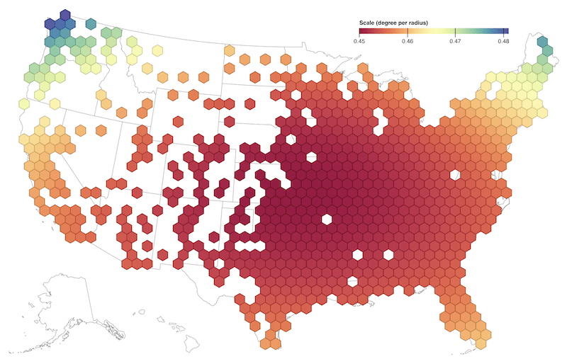
Coğrafi Bilgi Sistemleri (GIS) dünyası sürekli yenileniyor ve verileri daha etkili ve anlaşılır şekilde sunmak için farklı yöntemler geliştiriyor. Son zamanlarda popülerliği hızla artan yöntemlerden biri de Hex Grid (altıgen ağ) sistemidir. Hex Grid Nedir? Hex Grid, altıgen şekilli hücrelerden oluşan ve alanı tamamen kaplayan geometrik bir ağdır. Kare ya […]
Devamını Oku
Geospatial data management is essential to modern databases, especially for applications involving location-based services, geographic information systems (GIS), and spatial analysis. MySQL, a popular relational database management system, offers a suite of geospatial functions, allowing users to store, process, and retrieve geospatial data efficiently. Here are the various geospatial functions […]
Devamını Oku
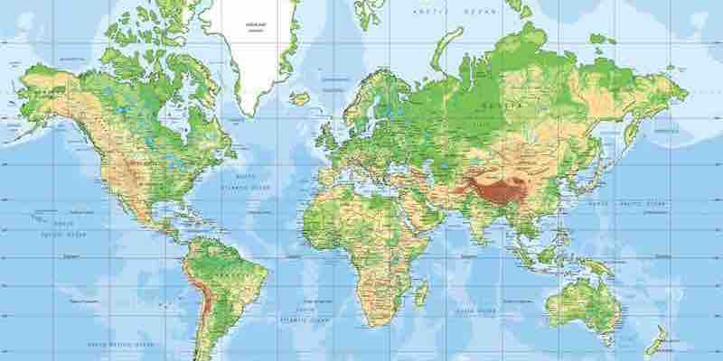
Have you ever wondered how we pinpoint any location on Earth with just a couple of numbers? This is where the concepts of latitude and longitude come into play. These two lines form a grid system that helps us accurately describe every point on the Earth’s surface. Let’s dive into […]
Devamını Oku
Uber-like apps have revolutionized the way we think about transportation and service delivery. However, the development of such apps is not without its challenges, especially regarding routing. This article delves deep into the technicalities of developing Uber-like apps, focusing on the challenges of routing and location determination. The on-demand delivery […]
Devamını Oku
Uber, the global ride-hailing giant, is not just about transporting people from point A to point B. Behind the scenes, there’s a vast and intricate world of maps and location technologies that power the platform. The article delves into the intricacies of digital and web mapping services, highlighting how they’ve […]
Devamını Oku
Organizational Approaches in Software Development Teams Conway’s Law states that “organizations which design systems are constrained to produce designs which are copies of the communication structures of these organizations.” In other words, how people in an organization communicate with each other will influence how they design and develop software systems. […]
Devamını Oku
How Trendyol Go matches orders with couriers to ensure timely and efficient deliveries Trendyol Go is a last-mile delivery service that provides same-day or next-day delivery for orders placed on Trendyol, Turkey’s leading e-commerce platform. To ensure that orders are delivered on time and efficiently, Trendyol Go has developed a […]
Devamını Oku
The Google Distance Matrix API is a powerful tool that calculates travel distance and time between two global points. It can be used for a variety of purposes, such as: The Distance Matrix API is easy to use and can be integrated with various programming languages. It is also very […]
Devamını Oku
A cutting-edge fraud prevention solution that can help them safeguard future growth. The food delivery industry is booming. In 2021, global food delivery revenue was estimated to be $136.1 billion, and it is expected to grow to $210.3 billion by 2027. Several factors drive this growth, including the increasing popularity […]
Devamını Oku
SRID stands for Spatial Reference Identifier, a unique identifier assigned to a spatial reference system used in Geographic Information Systems (GIS). SRIDs define the coordinate system, projection, and geographic location of the data being used in a GIS system. SRIDs are used in maps like Google Maps and Yandex Maps […]
Devamını Oku