Hindistan’da restoran sektörü hızla değişiyor. Bu değişimin merkezinde, yalnızca çevrimiçi siparişlere odaklanan “bulut mutfaklar” bulunuyor. Geleneksel restoranlardan farklı olarak, bu mutfaklar fiziksel bir mekâna ihtiyaç duymadan hizmet veriyor. Şimdi ise yapay zeka (AI) ve otomasyon, bu bulut mutfakları daha akıllı ve verimli hale getiriyor. 1. Mutfakta Yapay Zeka: Yeni Yardımcınız […]
Devamını Oku
The Verge’s article explores the concept of self-hosting and local-first software, presenting an intriguing perspective on software usage’s current and future state. The author’s journey with self-hosting reveals the challenges and potential of moving away from cloud services to more personal and controlled computing environments. The Challenge of Self-Hosting The […]
Devamını Oku
In the realm of database management, MySQL stands out for its robust features, one of which includes support for geospatial data. This is particularly useful for applications that need to store and query location data, such as mapping and location-based services. Two significant functions in this context are ST_SRID and […]
Devamını Oku
Geospatial data management is essential to modern databases, especially for applications involving location-based services, geographic information systems (GIS), and spatial analysis. MySQL, a popular relational database management system, offers a suite of geospatial functions, allowing users to store, process, and retrieve geospatial data efficiently. Here are the various geospatial functions […]
Devamını Oku
On-demand food delivery is a booming industry with rapid growth in recent years. Customers can order food from various restaurants and cuisines with just a few clicks on their smartphones and deliver it to their doorstep in minutes. However, this convenience has some challenges for customers and service providers. One […]
Devamını Oku
Amidst covid cases rising again, the enjoyment of eating restaurant-style meals while lounging in your jammies has persisted and will continue to do so. Top 5 Cloud Kitchens Delivering Scrumptious Food in India Cloud kitchens are a new way to experience food delivery. These kitchens only offer delivery and takeout […]
Devamını Oku
SRID stands for Spatial Reference Identifier, a unique identifier assigned to a spatial reference system used in Geographic Information Systems (GIS). SRIDs define the coordinate system, projection, and geographic location of the data being used in a GIS system. SRIDs are used in maps like Google Maps and Yandex Maps […]
Devamını Oku
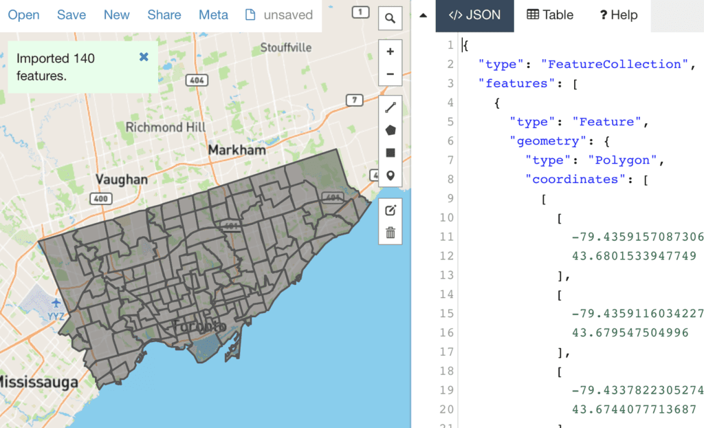
Internet Engineering Task Force (IETF) H. Butler Request for Comments: 7946 Hobu Inc. Category: Standards Track M. Daly ISSN: 2070-1721 Cadcorp A. Doyle S. Gillies Mapbox S. Hagen T. Schaub Planet Labs August 2016 The GeoJSON Format Abstract GeoJSON is a geospatial data interchange format based on JavaScript Object Notation […]
Devamını Oku