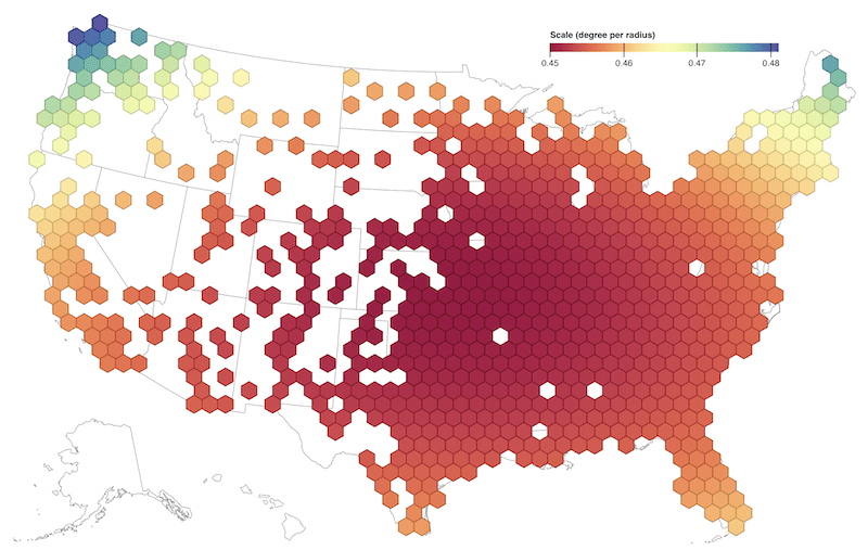
Coğrafi Bilgi Sistemleri (GIS) dünyası sürekli yenileniyor ve verileri daha etkili ve anlaşılır şekilde sunmak için farklı yöntemler geliştiriyor. Son zamanlarda popülerliği hızla artan yöntemlerden biri de Hex Grid (altıgen ağ) sistemidir. Hex Grid Nedir? Hex Grid, altıgen şekilli hücrelerden oluşan ve alanı tamamen kaplayan geometrik bir ağdır. Kare ya […]
Devamını Oku
Geospatial data management is essential to modern databases, especially for applications involving location-based services, geographic information systems (GIS), and spatial analysis. MySQL, a popular relational database management system, offers a suite of geospatial functions, allowing users to store, process, and retrieve geospatial data efficiently. Here are the various geospatial functions […]
Devamını Oku
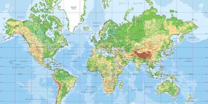
Have you ever wondered how we pinpoint any location on Earth with just a couple of numbers? This is where the concepts of latitude and longitude come into play. These two lines form a grid system that helps us accurately describe every point on the Earth’s surface. Let’s dive into […]
Devamını Oku
How Trendyol Go matches orders with couriers to ensure timely and efficient deliveries Trendyol Go is a last-mile delivery service that provides same-day or next-day delivery for orders placed on Trendyol, Turkey’s leading e-commerce platform. To ensure that orders are delivered on time and efficiently, Trendyol Go has developed a […]
Devamını Oku
The Vehicle Routing Problem (VRP) is a classic optimization problem that arises in many different contexts, such as delivery, transportation, and logistics. In the VRP, we are given a set of customers that need to be served, a fleet of vehicles, and a set of constraints, such as the maximum […]
Devamını Oku
Google Maps APIs are a powerful tool that can add location-based features to your applications. However, optimizing your usage of these APIs to ensure that you are getting the most out of them in terms of security, performance, and consumption is essential. Security Security is one of the most essential […]
Devamını Oku
Google Maps is a powerful tool that can be used to display maps, get directions, and find businesses. In React Native, you can use the Google Maps SDK to add Google Maps to your apps. One of the most popular features of Google Maps is the ability to track the […]
Devamını Oku
The Google Distance Matrix API is a powerful tool that calculates travel distance and time between two global points. It can be used for a variety of purposes, such as: The Distance Matrix API is easy to use and can be integrated with various programming languages. It is also very […]
Devamını Oku
Amazon is using real-time data to reroute drivers and keep packages moving. The company’s new Fleet Edge technology automatically detects changes in roads, traffic signs, and highways. This information then updates Amazon’s mapping software, providing drivers with the most up-to-date routing data. How Fleet Edge Works Fleet Edge uses various […]
Devamını Oku
Mapping the growing role of geospatial intelligence From Geomarketing to zone-based pricing, route planning to supply chain optimization, discover how leading companies use geospatial data to their advantage. In today’s challenging market, every business is searching for ways to do more with less. Geospatial intelligence is proving an invaluable tool […]
Devamını Oku